
Google Earth has recently updated their aerial imagery, capturing the flooding that swamped Houston earlier this spring. The latest imagery is dated April 2016, which provides a stark contrast from imagery taken in previous months.
Note: To access this imagery, you need to download Google Earth and utilize the historical imagery function. Click here for more information.
The images below are side by side comparisons of various locations in Houston where the flooding was visually striking. In the first three images, the before pictures on the left were taken in March 2016. In the last image, the before picture was taken in November 2015. CLICK ON THE IMAGES BELOW TO ENLARGE.
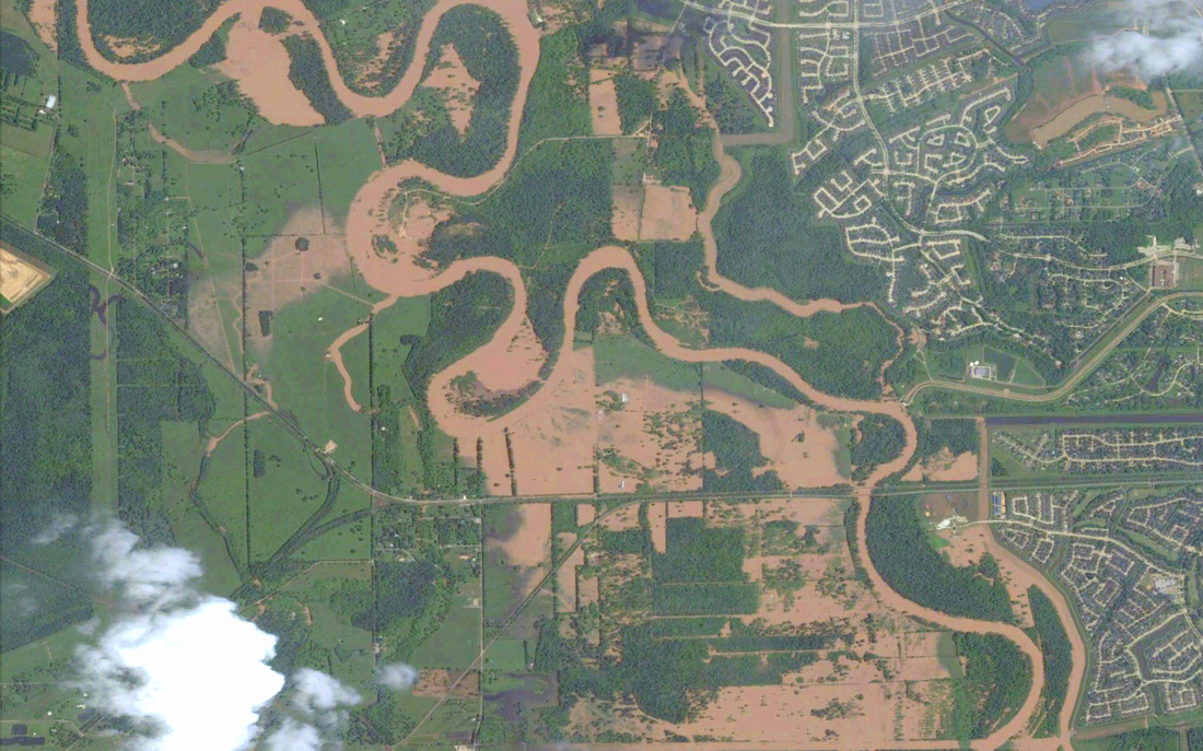
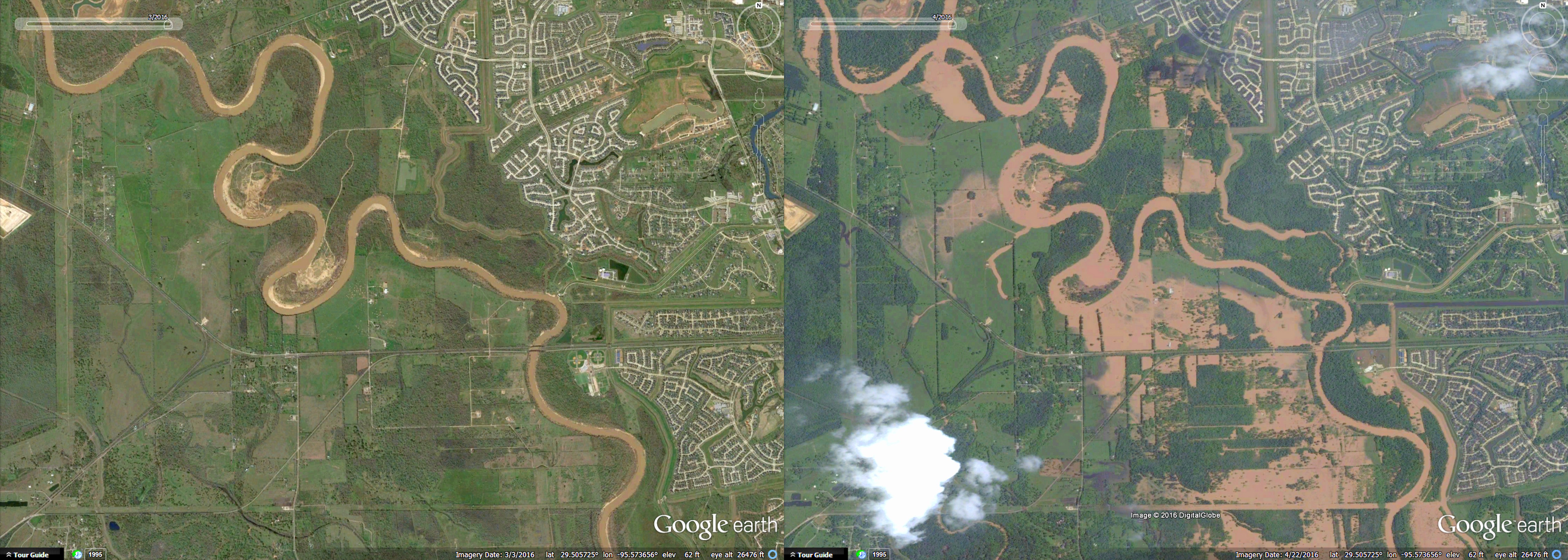
Brazos near Thompsons
Below is Brazos River flooding near Sienna Plantation, Riverstone, and the town of Thompsons. You can see the difference between the levee protected neighborhoods north and east of the river vs. the rural land to the west and south around Thompsons.
Below is Brazos River flooding near Sienna Plantation, Riverstone, and the town of Thompsons. You can see the difference between the levee protected neighborhoods north and east of the river vs. the rural land to the west and south around Thompsons.
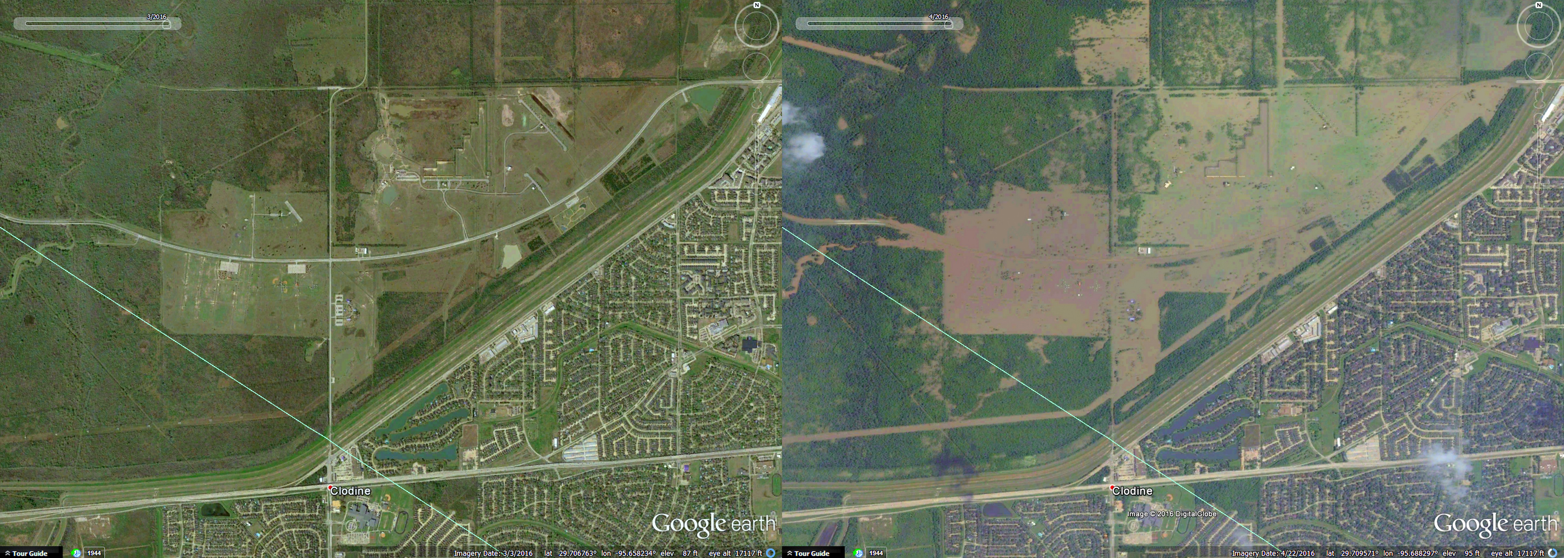
Barker Reservoir
Below is George Bush Park and Barker Reservoir, near the intersection of Westheimer Parkway and FM 1093. All roads running through the reservoir are submerged. Although this is a temporary loss of popular park space, the intended use of this land is as a reservoir; and it's doing its job.
Below is George Bush Park and Barker Reservoir, near the intersection of Westheimer Parkway and FM 1093. All roads running through the reservoir are submerged. Although this is a temporary loss of popular park space, the intended use of this land is as a reservoir; and it's doing its job.
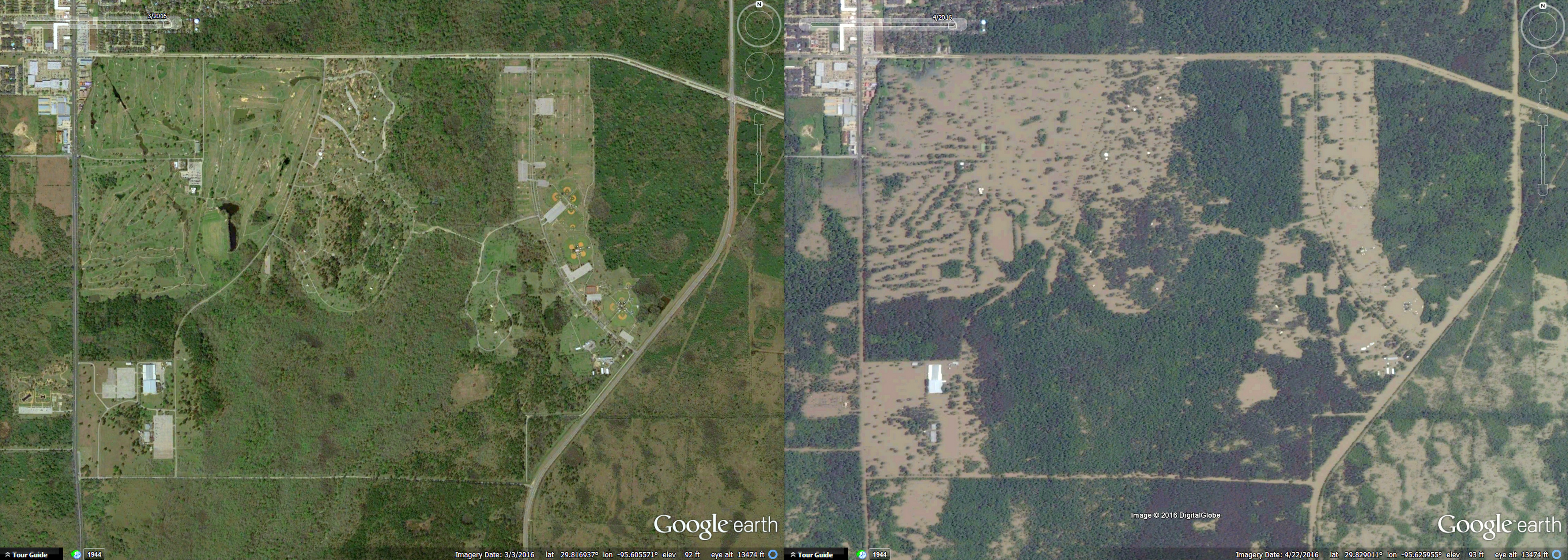
Addicks Reservior
Below is Addicks Reservoir and Bear Creek Park. Clay Road is on the north, Highway 6 is on the west, and Eldridge is on the east. Again, all roads are submerged. Similar to Barker Reservoir, the primary purpose of this land is flood mitigation. Without the Addicks and Barker Reservoir, flooding in Houston (and especially west Houston) would be more frequent and severe.
Below is Addicks Reservoir and Bear Creek Park. Clay Road is on the north, Highway 6 is on the west, and Eldridge is on the east. Again, all roads are submerged. Similar to Barker Reservoir, the primary purpose of this land is flood mitigation. Without the Addicks and Barker Reservoir, flooding in Houston (and especially west Houston) would be more frequent and severe.
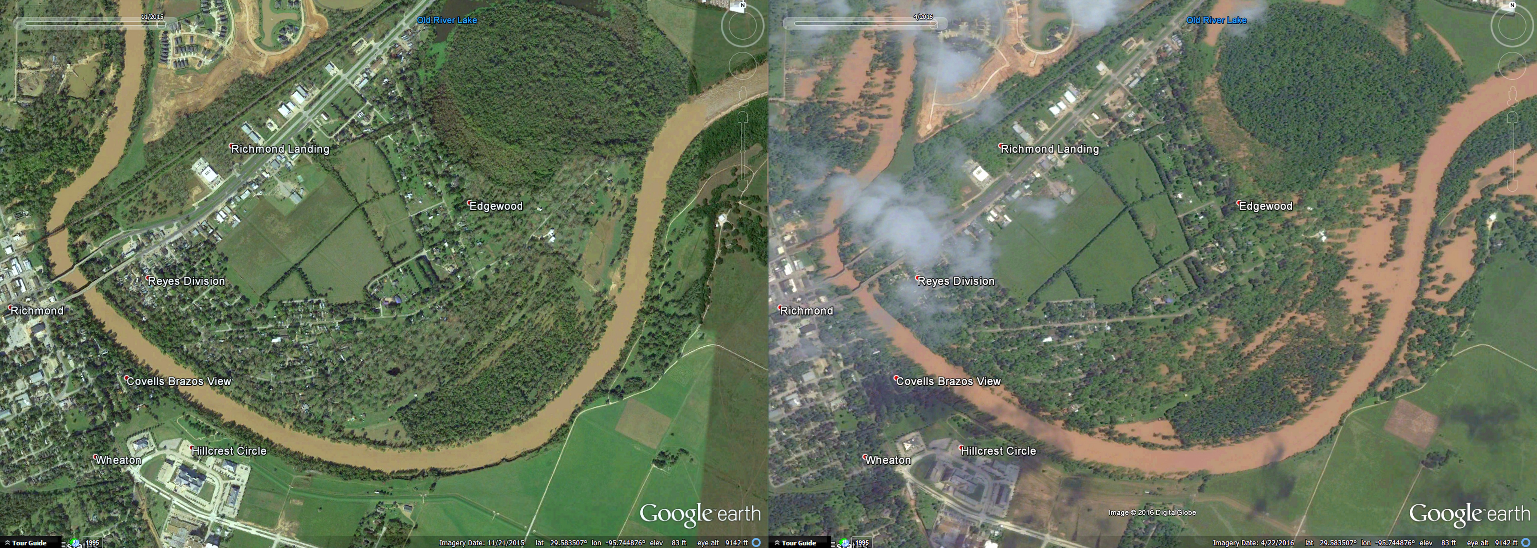
Brazos near Richmond
Below is another shot of the Brazos River, this one depicting the Richmond area. In this image you can see significant flooding around homes near the Brazos. The bridge crossing the river on the west is Highway 90.
Below is another shot of the Brazos River, this one depicting the Richmond area. In this image you can see significant flooding around homes near the Brazos. The bridge crossing the river on the west is Highway 90.
 RSS Feed